

Bidean Bad na h-Iolaire [Bidein Bad na h-Iolaire]
Good walks are even better shared.
NN1170 : Summit cairn and summit ridge of Bidean Bad na h-Iolaire
Trevor Littlewood Photo source
Overview
Bidean Bad na h-Iolaire
Bidean Bad na h-Iolaire is a majestic Munro located in the stunning Scottish Highlands, rising proudly to an elevation of 1035 meters. Its rugged beauty and varied terrain make it a beloved destination for hikers of all levels.
Geology
The geology of Bidean Bad na h-Iolaire is fascinating. The mountain consists primarily of metamorphic rock, shaped through millennia of geological activity. For the keen geologist, the exposed rock formations and striking landscapes tell a story millions of years in the making.
Routes
There are multiple routes up Bidean Bad na h-Iolaire, but two of the most popular are:
- Bidean Bad na h-Iolaire from Glen Etive: This challenging route, covering approximately 12 km in about 5 hours, offers breathtaking views and a steep ascent, making each step worthwhile.
- Bidean Bad na h-Iolaire via Coire na Tulaich: Covering about 14 km and taking around 6 hours, this route provides a rewarding alternative with stunning vistas along the way.
Summit Features
Reaching the summit, hikers are greeted by a grand cairn and unparalleled views of the surrounding peaks. It's a perfect place to take a moment to revel in the achievement while sipping some well-deserved water—or perhaps a cheeky snack!
Terrain
The mountain's terrain is a mix of rocky outcrops, grassy slopes, and occasional bogs. Expect a bit of a workout here—both your legs and your sense of humour will be put to the test!
Views
The summit vistas are nothing short of spectacular; notable landmarks like Ben Starav and the Black Mount dominate the horizon. Timing your hike for late spring or early autumn can provide the best experience, where a clear day is like finding a pot of gold at the end of the rainbow.
Hazards
While the beauty of the area is captivating, it is essential to remain cautious. The rocky paths can be slippery, and bogs may threaten your hiking boots' integrity. And let's be honest, no one likes soggy socks!
Access
Access to Bidean Bad na h-Iolaire is straightforward; however, parking is limited in Glen Etive, so arrive early. If you prefer public transport, check out local bus options that can drop you nearby before you tackle the trails.
Facilities
Keep in mind that once you're on the mountain, there are no facilities—so pack your snacks and drinks. A lovely café awaits you in Dalness once you’ve completed your adventure, the perfect chance to reflect on the day’s triumph.
History
The mountain name suggests its historical significance, translating to 'the peak of the eagle's eye.' Those who have roamed this land have revered it for centuries, captivated by its wild beauty and rich history.
In summary, Bidean Bad na h-Iolaire offers a fantastic hiking experience that embodies the raw spirit of the Scottish Highlands. Whether you’re a seasoned hiker or just looking for a day out in nature, this mountain promises an unforgettable adventure.
So pack your bags, lace up those boots, and get ready for a day of trekking amidst the breathtaking scenery that Scotland is renowned for!
Explore routes near Bidean Bad na h-Iolaire [Bidein Bad na h-Iolaire]
Walks starting near this hill. Open a route to check its map, distance and full itinerary.
Ben Nevis via Mountain Path
View route
Banavie to Glen Loy Aqueduct: Neptune’s Staircase Canal Towpath
View route
Fort Augustus to Kytra Lock: Caledonian Canal Towpath
View route
Killin: Falls of Dochart, Finlarig and Moirlanich Longhouse
View route
Route planning notes
These notes describe possible approaches. Check a route's map and access information when planning your walk.
Bidean Bad na h-Iolaire from Glen Etive
A popular route begins from the picturesque Glen Etive, taking hikers through lush greenery before ascending steeply towards the summit.
Bidean Bad na h-Iolaire via Coire na Tulaich
This route is slightly longer but offers stunning views of the surrounding mountains as it winds through Coire na Tulaich before heading to the summit.
Make a day of it, together
Find someone to share the walk with, or organise a day out along a route you like.
Photo Gallery
View all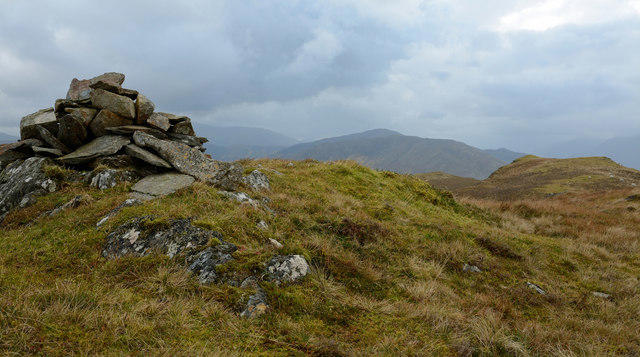 Photo could not load
NN1170 : Summit cairn and summit ridge of Bidean Bad na h-Iolaire
Trevor Littlewood
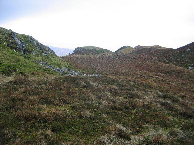 Photo could not load
NN1170 : Bog, Bidhein Bad na h-Iolaire
Richard Webb
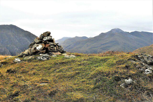 Photo could not load
NN1170 : Bidean Bad na h-Iolaire
Raibeart MacAoidh
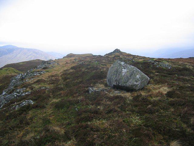 Photo could not load
NN1170 : Erratic, Bidhein Bad na h-Iolaire.
Richard Webb
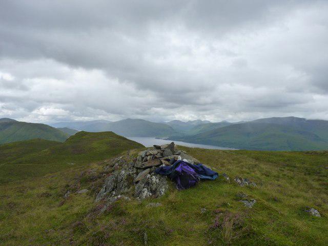 Photo could not load
NN1170 : Summit cairn of Bidhein Bad na h'Iolaire (528m) with Loch Linnhe beyond
Phillip Williams
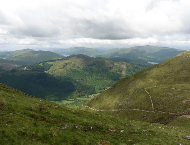 Photo could not load
NN1170 : View to the west from the slopes of Ben Nevis
Roger Cornfoot
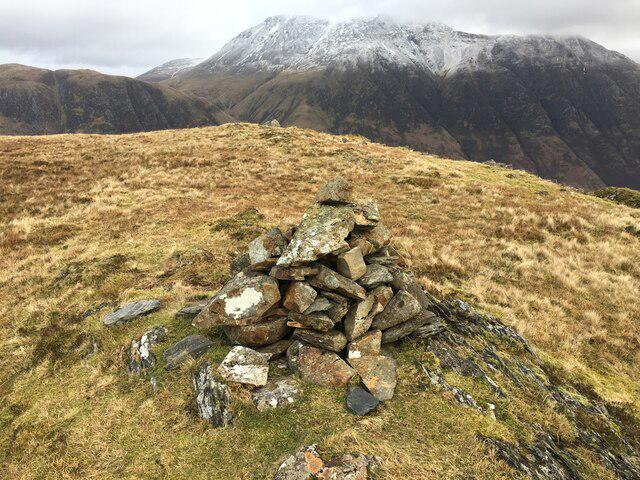 Photo could not load
NN1170 : Cairn on Bidean Bad na h-Iolaire
Steven Brown
Hill facts and local notes
Classifications
Elevation
528m
1,732 ft
Prominence
263m
Coordinates
56.7905, -5.0880
NN114708
OS Map
41
Explorer: 392
At the Summit
The summit boasts a large cairn, which offers a sense of achievement when reached. The panoramic views stretch across the Highlands, making it a rewarding spot for any hiker.
Terrain & Geology
The mountain is primarily composed of metamorphic rock, formed through high pressure and temperature conditions typical of the Scottish Highlands. The rocky outcrops display striking formations that are a geologist’s playground, offering insights into the forces that shaped this rugged landscape.
Views & Scenery
From the summit, hikers can enjoy stunning views of Ben Starav, the Black Mount, and the sprawling expanse of the Highlands. On a clear day, the vistas are nothing short of breathtaking.
History & Heritage
Name Origin
The name 'Bidean Bad na h-Iolaire' roughly translates to 'the peak of the eagle's eye', hinting at the sweeping views that eagles must have enjoyed from its heights.
Historical Significance
This mountain has long been a favourite among hikers and climbers, embodying the very essence of the wild Scottish landscape. Its charm draws visitors from both near and far.
Getting There & Facilities
Parking
There is limited parking at the start of Glen Etive. A small car park is available, but arrive early to secure a spot, as it can fill up quickly with eager walkers.
Public Transport
Accessibility is mainly via car, though some adventurers opt for public transport from nearby towns, followed by a bit of walking. Check local bus services for the latest information.
Nearby Facilities
There are no facilities on the mountain itself, so be sure to pack your own supplies. The nearest café can be found in the village of Dalness for a well-deserved treat post-hike.
Safety Information
Known Hazards
- Uneven terrain, potential for sudden weather changes, and steep drops near the summit require caution. Boggy areas can also lead to wet socks—a true hiker’s nightmare!
General Safety Tips
- Check weather conditions before setting out
- Carry appropriate clothing and equipment
- Let someone know your planned route
- Take a map, compass, and GPS device
- Carry emergency supplies: food, water, first aid kit, torch
Hills
Some common questions about the hills answered
Are there group walks up Bidean Bad na h-Iolaire [Bidein Bad na h-Iolaire]?
Many walkers use Walkmates to join or organise walks with others. You can check for group walks around Bidean Bad na h-Iolaire [Bidein Bad na h-Iolaire] through the maps
Are there other walkers around Bidean Bad na h-Iolaire [Bidein Bad na h-Iolaire]?
Activity varies by location and time, but Walkmates lets you see whether others have shared walks or shown interest in this area. Find other people through the walking friends search walking friends for Bidean Bad na h-Iolaire [Bidein Bad na h-Iolaire] search or of course create your own walk for Bidean Bad na h-Iolaire [Bidein Bad na h-Iolaire]
Can I organise a walk to Bidean Bad na h-Iolaire [Bidein Bad na h-Iolaire]?
Yes. If there aren’t any walks listed already, you can create a walk and make it available for others to join.
If you're signed up to Walkmates, you can create a walk to Bidean Bad na h-Iolaire [Bidein Bad na h-Iolaire].
How do I find a walk up this hill?
There are often multiple ways to walk this hill, depending on experience and route preference. Walkmates helps you explore walks and routes that others have shared.
Can I suggest a new route up Bidean Bad na h-Iolaire [Bidein Bad na h-Iolaire]?
Yes. You can suggest or create routes to share with others. Walkmates focuses on the social side of walking, so routes are used to help people organise walks and explore areas together, rather than as detailed navigation tools or route libraries.
Other uses really appreciate knowledgeable walkers sharing their routes. Share your favourite route to Bidean Bad na h-Iolaire [Bidein Bad na h-Iolaire] here
The is an error or something incorrect about this hill. How do I let you know?
We always strive to keep the information on Walkmates as accurate as possible. If you find an error, please let us know through the contact form and we'll aim to correct it as quickly as possible
Community Discussion
Comments
Location
![Bidean Bad na h-Iolaire [Bidein Bad na h-Iolaire] location map](https://cdn.walkmates.com/hill-maps/hill-sources/342/56.79050_-5.08797.png)
Grid reference: NN114708
View on OpenStreetMapOpens a map in a new tab, centred on the hill.
![Ben Nevis [Beinn Nibheis]](https://cdn.walkmates.com/gallery-images/44e34d25abc849e78f7b99a97863fffb.jpg)
No comments yet. Be the first.